STRADIVARI®
Making route images and road condition data quickly and easily accessible …… this was the main objective in the development of the STRADIVARI® programme system. The software, which was developed in-house, meets these requirements from the single-user version to the server application. Running under the Windows operating system, the recorded and processed results of a condition survey are made available to the customer on a data carrier. STRADIVARI® can thus be used directly, no installation is required.
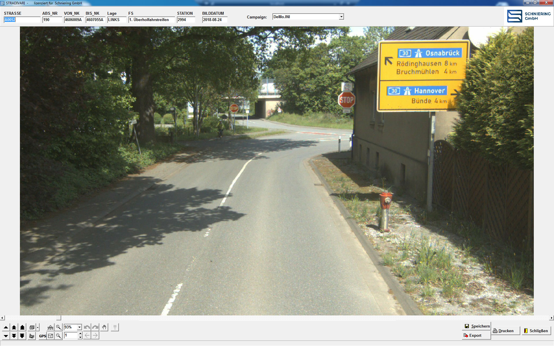
The image data of the condition survey (front image, left/right side images, rear camera image and surface image) can be called up in relation to the location and the respective route can be virtually travelled. The images from the front and side cameras can also be arranged together to create a panoramic image.
All image data can be printed out or transferred to other applications such as MS Word.
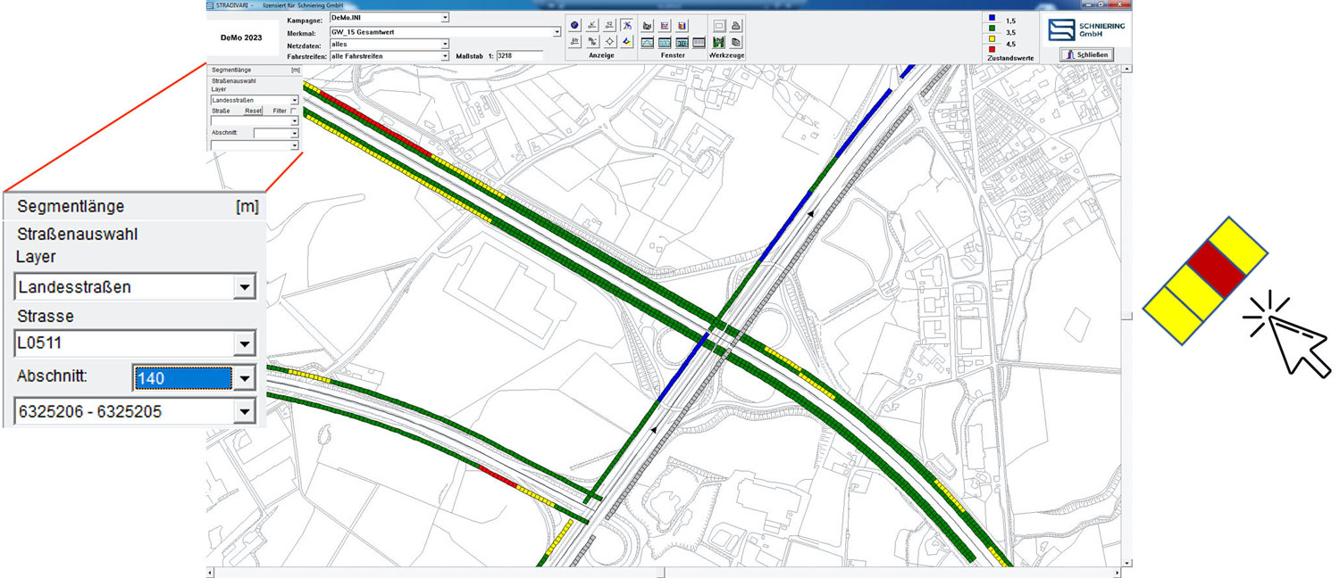
The selection of the road segment or road image to be viewed can be done quickly and easily by “mouse click” on the corresponding segment in the map display of the network. Alternatively, the street and the section can be selected in the selection list.
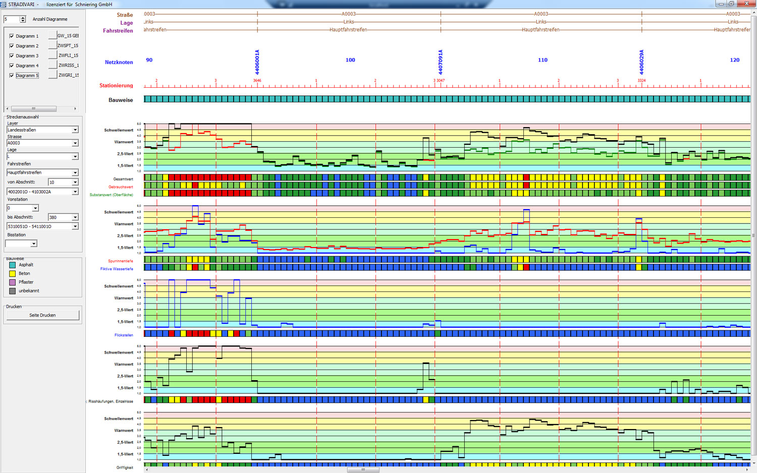
Route and raw data tapes show selected condition values or condition variables and allow a detailed analysis of the monitored routes. The respective route and raw data tapes can be printed out digitally (pdf file) or on paper, whereby continuous printing is possible. A legend is added to each printout, in which individual logos and project designations can be integrated.
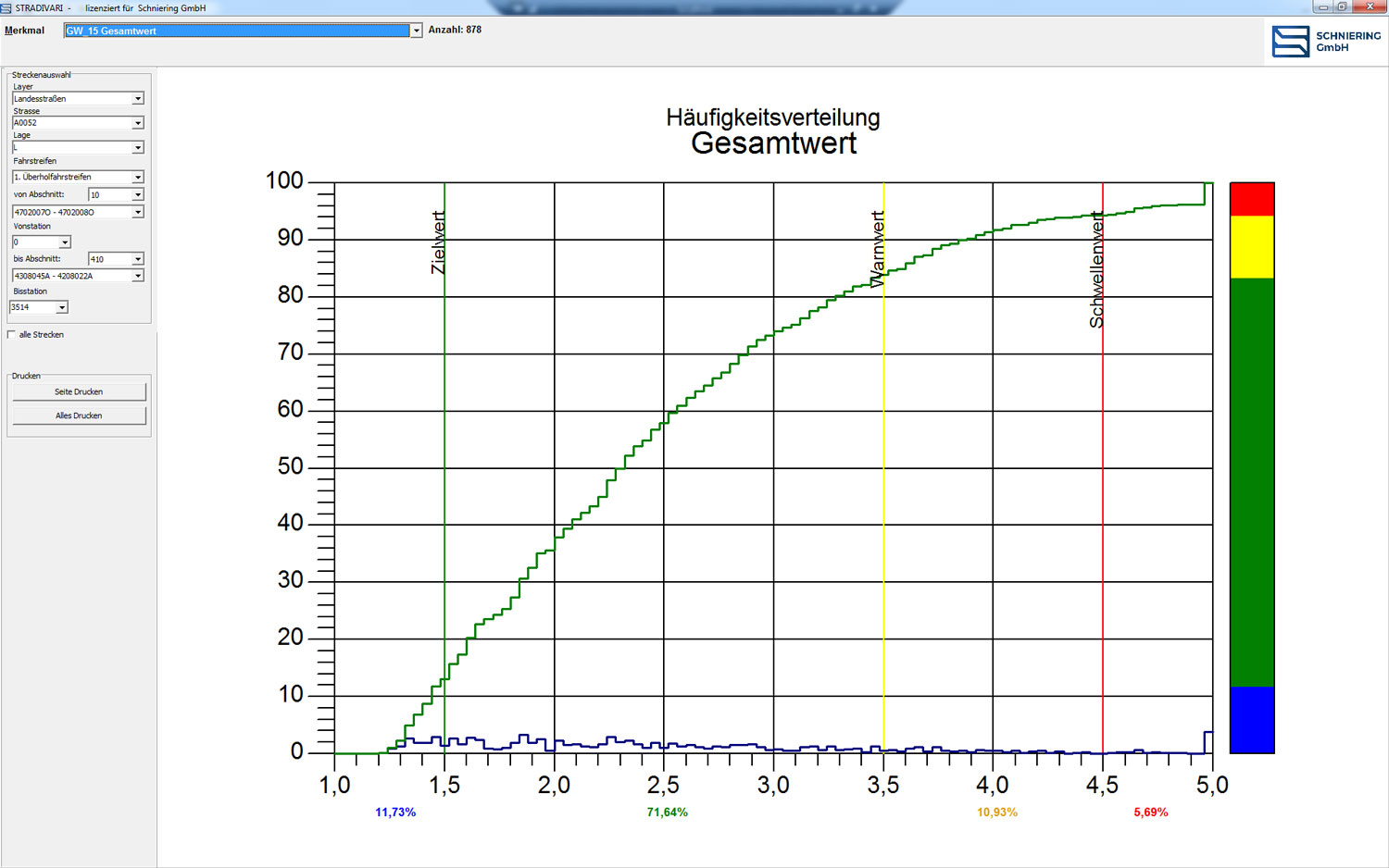
Frequency distributions show the percentage distribution of the total value, the partial values or also individual condition values of a route in the selected area. This can be used, among other things, to show maintenance requirements in a simple and comprehensible way and to compare different routes with each other in a standardised way.
