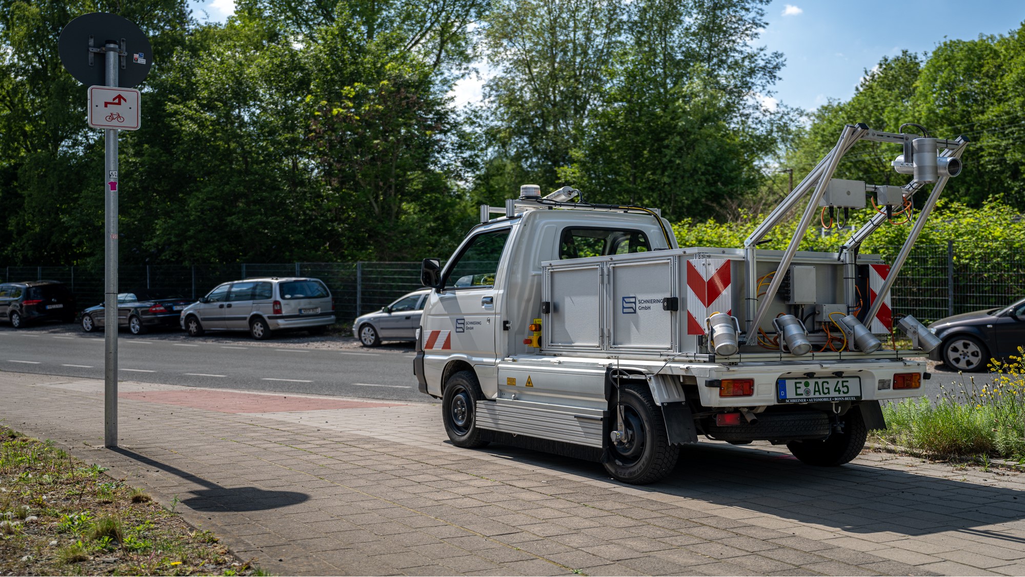
MEASURING VEHICLE ARGUS®-AGIL
Our multifunctional ARGUS®-Agil measuring systems are used to record the condition of cycle paths, mainly throughout the network. The range extends from municipal networks to national networks. Other applications are condition surveys in the secondary road network, if the ARGUS® system cannot be used, as well as surveys of service roads.
The vehicle is designed in such a way that (cycle) paths from a width of 1.2 metres can be recorded without any problems.
The ARGUS®-Agil measuring system has the following sub-systems for condition monitoring:
- Longitudinal evenness measuring system according to the HRM method in accordance with the requirements of the “TP-Eben Berührungslose Messungen” in the right and left rolling lane by means of high-precision individual lasers which work according to the triangulation method.
- High-resolution, orthogonally aligned camera with artificial lighting to capture images of the road surface with a recording width of 2.5 metres
- High-resolution front and rear camera with special aperture control for fast-driving recording of videos or individual images of the cycling path area (route images)
- Highly clocked laser sensor for recording the macrotexture in the central position of the cycle path
The measuring system can be used to monitor the condition of the vehicle at speeds of up to 60 km/h. Due to the built-in safety devices, the vehicle is intrinsically safe. The detection itself is completely speed-independent thanks to a powerful trigger system in conjunction with a network structure that connects the individual subsystems with each other. Traffic obstructions are avoided as far as possible by “swimming along” with the cycling traffic.
The data and images recorded by the ARGUS®-Agil measuring system in a metrological and thus objective manner represent an essential basis for:
- the provision of network-wide condition information as objective baseline information for short-, medium- and long-term conservation decisions.
- the optimised use of increasingly limited resources
- transparent decisions within building administrations as well as in external presentation
- Control over the effect of measures and the effect of their delays
- the forecast of the future network condition
- the practical findings on the success/failure of types of measures and building material concepts in conservation
In order to enable the true-to-position mapping of the captured data and images onto the digitised road network, a high-precision position detection system using the GNS system (Global Navigation Satellite System) is integrated into every measuring system. Coupled with distance measurement via a rotary encoder, standard accuracies of typically ± 0.5m are achieved. Using correction data from reference stations, this accuracy can be improved into the sub-centimetre range in post-processing if required.
In addition to the pure position data, the GNS system also provides position data of the vehicle, which is used to calculate the longitudinal and lateral inclination, among other things.
The recorded measurement data are evaluated and assessed according to the order-specific specifications and taking into account individual concerns, usually on the basis of regulations such as ZTV ZEB-StB , the VSS standards or also METHODE D’ESSAI LPC, and are usually handed over to the client in the following formats:
- Raw geodata / raw raster data according to the format definition of the Federal German Highway Research Institute (BASt)
- Map-Info relation
- shape-file
- Visualised in STRADIVARI®
- Result file on CSV, Excel or dBase basis
- State maps / strip maps / raw data strip maps in digital and printed form
The corresponding image data is transferred to an image database in the specified storage system on data media.


